Met Office says tornado could cause 'significant damage' to parts of UK amid Storm Isha - full details
A tornado could cause "significant damage" to parts of the UK amid Storm Isha, the Met Office has warned.
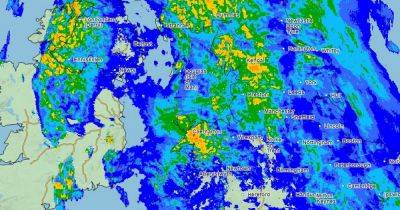
A “tornado watch” zone was issued for Northern Ireland, as well as parts of Scotland and northern England by the Tornado and Storm Research Organisation (Torro) this afternoon (Sunday). It means a “strong tornado” is possible in those regions.
Met Office forecaster Marco Petagna told the PA news agency: “There is a potential that we could see the odd isolated tornado largely tied in with the squally cold front mainly in western parts of the UK on Sunday evening.
Try MEN Premium now for FREE... just click here to give it a go.
“They can cause some significant damage but often on a very localised scale, they often don’t tend to last very long.”
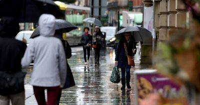
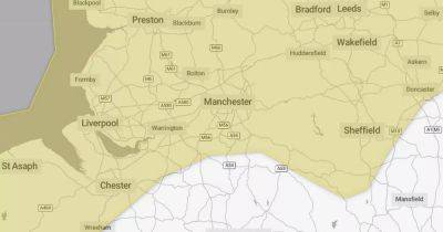
As Storm Isha swooped in today, the Met Office upgraded its weather warnings with an amber wind alert - which includes a 'danger to life' warning - covering most of the UK.
The 'Tornado Watch' covers all of Northern Ireland and Ireland, most of Scotland and some areas of northern England. It says there 'is the risk of a few tornadoes' including a 'strong tornado'.
On its website, it says: "Across the Tornado Watch area, a potent mid-level trough and speed max (500 hPa mid-level jet max of ~120 knots) will overspread the frontal zone, and induce a powerful low-level jet in advance of the front (850 hPa flow of ~90 knots).
"This will produce exceptional low-level shear values across the area, especially across the RoI and N Ireland, e.g. 0-1km SREH values of over 700 J/Kg, and 0-3km values of around 1000 J/Kg. There will also be some modest instability, which the strong shear should augment, allowing the chance of rotating structures, including shallow supercells, to develop,
Related News