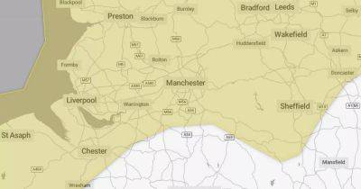
Met Office map shows exact time snow bomb forecast to hit Greater Manchester next week
A Met Office map shows when a snow bomb is forecast to hit Greater Manchester next week - ahead of what could be the 'worst snowstorm in 14 years'.
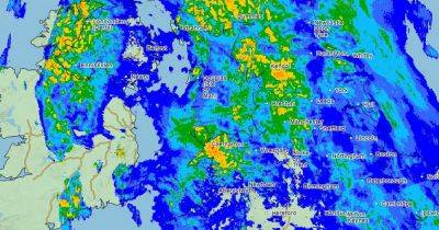
According to the UK precipitation map, a huge cloud of snow is set to move over our region on Monday evening (January 15) and into the early hours of Tuesday as as an 'Arctic influence' descends over the country. Temperatures are set to plummet to freezing, though it will feel more like -3C.
Freezing temperatures are then forecast into Tuesday morning with the mercury not expected to rise over 3C until the middle of next of week. James Madden, an Exacta weather forecaster, has predicted the snow risk in the UK next week is greater than any year since 2010.
Try MEN Premium now with our amazing New Year offer... just click here to give it a try.
He told GB News: "Over the next few weeks, there will be a high chance of snow with the risk higher than the same period over the past few years or indeed, since the big freeze of 2010. It is likely we are about to start seeing images of vast regions of the nation covered in snow during a cold spell which is likely to hold out for an extended period.
"As well as the risk of snow, we will see harsh overnight frosts and the coldest temperatures dipping as low as -15C in the coldest parts of the country over the coming week."
Met Office deputy chief forecaster Tony Wardle said: "There is the potential for some disruptive snow through the middle to latter part of next week as warmer Atlantic air attempts to push in from the southwest. As this occurs, some substantial snow could fall in some places, but the details of that are uncertain at the moment."
The Met Office's long range forecast, from Monday January 15 to Wednesday, January
Related News