Met Office warns 'weather bomb' to hit UK as 'very powerful' system set to bring 80mph wind
The Met Office has issued a warning as a 'very powerful' weather system heads towards the UK, bringing 'disruptive' weather and winds gusts of up to 80mph.
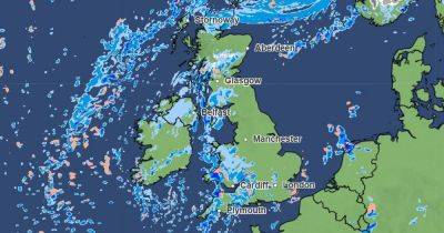
Overnight on Thursday, a "very deep" area of low pressure is expected to strengthen as it crosses the Atlantic and heads towards the UK, bringing strong winds and heavy rainfall, the Met Office said.
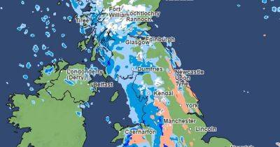
On Friday, the strongest winds are expected to be across Northern Ireland and western Scotland, where gusts could be 80mph or higher in coastal areas. The Met Office has issued a yellow weather warning for these areas which will last until Saturday morning.
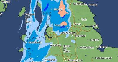
In the Met Office's latest video forecast, meteorologist Jonathan Vautrey said a "very powerful jet stream" will pick up the area of low pressure, causing it to rapidly deepen it as it travels across the Atlantic. "By Thursday we see a lot of isobars developing on the chart here indicating it is a very deep and very powerful system," he said. "It will continue to move towards us as we head into Friday with some very strong winds, heavy rain and also some snow possible at times."
The Met Office said the weather system could bring the "strongest winds of the winter so far" and some "potentially disruptive weather". It said "severe gales" are possible in the west of the UK.
The yellow weather warning for wind covers west Scotland and Northern Ireland and will be in place from midnight on Friday until midday on Saturday. The weather warning states: "A deep area of low pressure is expected to pass close to or across the northwest of the UK on Friday and Saturday. It will bring a spell of very strong southeasterly to southwesterly winds with gusts reaching 50 to 60mph inland and 70 to 80mph along coasts (and perhaps
Related News