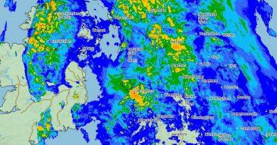
Met Office weather map shows when Greater Manchester can expect more snow this week
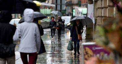
Roads were closed and schools shut on Tuesday after snow fell across the region overnight.
A yellow snow and ice warning remains in place for Greater Manchester for the rest of the day and forecasters predict that 'further snow showers, perhaps merging into a longer spell of snow, are likely to cause further disruption on Tuesday'.
Weather warnings are also in place for Wednesday and Thursday. The latest Met Office weather maps show when Greater Manchester can expect more of the white stuff over the next few days.
Join our WhatsApp Top Stories and Breaking News group by clicking this link.
According to the forecast parts of Bury, Rochdale, Oldham and Tameside are expected to see more snow from around 6pm onwards on Tuesday.
This is expected to hang around until the early hours of Wednesday morning - with other areas of the region getting a blast of heavy rain. Wednesday's forecast so far looks clear however it will remain cold with temperatures staying freezing - or just below - for most of the day.
According to the Met Office weather map, in the early hours of Thursday morning parts of Salford, Wigan, Bolton and Trafford could see some snow. More snow may return to this area from around 9pm on Thursday.
So far the forecast for Friday is clear however periods of rain and sleet could fall across Greater Manchester om Saurday - this could turn to snow in parts of Oldham and Tameside, the weather map shows.
According to the Met Office said a 'cold plunge of Arctic air' has moved south across the whole country over the past few days, making it 5C to 6C lower than usual for this time of year.
More than 40cm of snow could be seen on high ground in north-west Scotland by the end of Friday as it continues to build up
Related News