Met Office map shows when and where snow will fall in Greater Manchester tomorrow
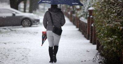
Parts of Greater Manchester are braced for another round of wintry weather on the first day of March. Snow is forecast to hit parts of the region tomorrow morning.
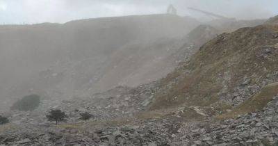
The Met Office is warning that snow 'may bring disruption' in some areas, particularly on higher ground, such as the Pennines. In the latest Met Office weather maps published today (February 29), some areas to the north and east of Manchester appear braced for a flurry of snow.
It's first expected to arrive on higher ground above Wigan and Bolton from around 7.15am, before a weather front moves from west to east. Areas to the east of Manchester - including parts of Rochdale, Oldham and Tameside - could see snow from around 8am.
Try MEN Premium now for FREE... just click here to give it a go.
Snow could be at its heaviest in the region after 9am, according to the Met Office. Areas around the Pennines and the Peak District will see the heaviest of the snow.
Met Office maps show that areas including Bolton, Rochdale, Oldham and Tameside could see further, more sporadic flurries of snow throughout the afternoon until 4pm. Some light snow showers could continue in the early evening.
Forecasters are expecting a cold day throughout Friday across Greater Manchester. In Saddleworth, temperatures are expected to hit 2C while snow falls, and climb no higher than 3C later in the afternoon.
Manchester is forecast for highs of 5C and a low of 2C, with rain expected throughout the day in the city. Other areas to the south and west of Greater Manchester are also expected to see a wet day.
The Met Office forecast for the North West says: "Breezy with rain and snow moving north during the morning. The snow may bring disruption in places, mainly over higher ground.
"Drier
Related News