Exact time Storm Éowyn will hit UK with wind gusts of 100mph forecast
Storm Éowyn is set to batter the UK with wind gusts of up to 100mph in the worst hit areas.
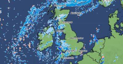
The Met Office issued a rare red alert for wind, covering the whole of Northern Ireland and parts of central and southern Scotland, ahead of the storm hitting on Thursday evening. It is expected to cause severe disruption and people in areas covered by the warning are being warned there is 'danger to life' due to flying debris and large waves.
Schools have been advised to shut and people have been told not to travel ahead of the storm's arrival. The deep area of low pressure has strengthened rapidly as it crosses the Atlantic and it is excepted to bring "very strong" winds to UK shores from tonight.
Storm Éowyn will reach the island of Ireland first, where the strongest winds are predicted, before striking Scotland and northern England from the early hours of Friday morning.
In the UK, the strongest winds are expected throughout Friday, with the red warning in place in Northern Ireland from 7am to 2pm and in Scotland between 10am and 5pm. Meanwhile, amber weather warnings for wind have been issued for northern England from 6am until 9pm, and a yellow weather warning covers most of southern England for the whole of Friday.
Met Office chief meteorologist Paul Gundersen said: "We reserve the issuing of red warnings for the most severe weather which represents a likely danger to life and severe disruption, and that is the case with Storm Éowyn.
"While it will be widely very windy on Friday, with additional hazards from rain and snow, the strongest winds and most significant impacts are likely in Northern Ireland and central and south-western parts of Scotland within the red warning areas, where winds could gust 80 to 90mph quite
Related News