Greater Manchester weather LIVE with amber weather alert in place after week of snow and ice
The region is continuing to feel the effects after a week of freezing weather. Sub zero temperatures have seen the blankets of snow and ice left earlier in the week remain in place making affecting public transport and making many roads treacherous.
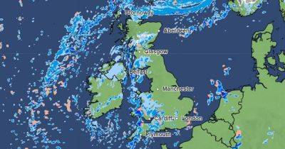
There were weather warnings in place for the majority of the week with the icy weather bringing chaos to the region. The UK recorded its coldest night of the winter so far on Friday night.
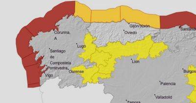
The Met Office has confirmed that the mercury dipped to is lowest of the year so far in a sleepy Scottish hamlet, where lows teetered near -20C. In Greater Manchester, there are no currently no weather warnings in place. However, temperatures again dipped below freezing overnight.
Whilst the forecast for Sunday and onwards is better, with temperaturees expected to slowly rise, an amber cold weather alert remains in place. The alert, issued by the UK Health Security Agency (UKHSA) been due to expire at midday today (Sunday).
However it will now remain in place until 9 am on Tuesday, 14 January, with the Met Office forecasting severe cold conditions continuing well into next week in parts of the country.
This was the scene above Edale in the Peak District this morning.
Watching the dawn above Edale pic.twitter.com/IimB7qHvBY
A cold and in places frosty start with a few fog patches. Often cloudy through the morning with sunny spells developing more widely by the afternoon. Feeling a bit milder. Maximum temperature 5 °C.
Sunday looks like the day of change but the majority of the day should still be cold and cloudy. Winds will pick up later in the day and will eventually switch to a milder southwesterly direction.
Chilly especially in the wind, but overnight temperatures will start to rise as
Related News